


Distance and Area Measure
Mierz ziemię, drogi, parki, kraje, jeziora itp. Oblicza odległości, obszary i obwody.
Funkcje, które ta aplikacja oferuje, że większość konkurentów nie:
- Dodać niestandardowe jednostki odległości i powierzchni.
- Rysowanie wielokątów wnętrza. Na przykład obszar lądowy z wody usuwane.
- Dodać punkt na środku ścieżki (większość tylko umożliwiają dodawanie do końca ścieżki) Naciśnij, aby dodać na końcu ścieżki. Naciśnij długo, aby dodać w środku ścieżki.
- Zamienić dwa punkty w ścieżkę lub Wielokąt.
- Dodać bieżącą z odbiornika GPS.
Funkcje:
- 3 opcji warstwy mapy
- Eksport i import plików .kml za pośrednictwem Dropbox, iCloud, e-mail, itp
- Piny można przeciągać i edytować ręcznie
- Nazwa, zauważa, a kolor pola dla każdej ścieżki i Wielokąt
- Wysłał lub dane tekstowe wiadomości ścieżki i Wielokąt
- 4 tryby szczegółowości. Wyświetlić tylko te informacje, które chcesz zobaczyć
- Wyszukiwanie po kod pocztowy, miasto, adres, itp
- Get adresy w pobliżu point na mapie
4 tryby rysunek:
- Ścieżka
- Wielokąt
- Wielokąt z pustych miejsc wewnątrz
- Brak trybu edycji (aby zapobiec przypadkowej zmiany)
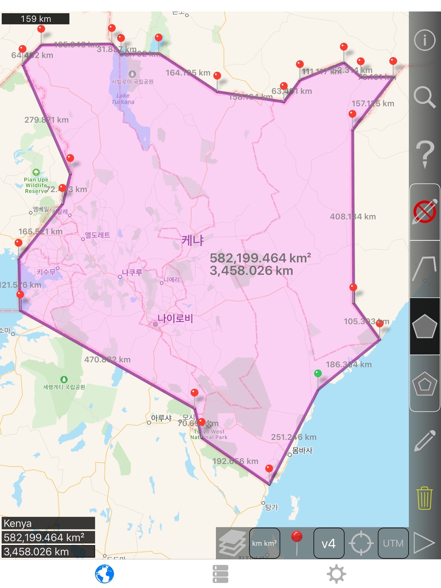
Wartości wyświetlane dla ścieżki:
- Całkowita odległość
- Odległość dla każdej trasy
Wartości wyświetlane dla wielokątów:
- Obszar
- Obwód
- Odległość dla każdej strony
Dodać punkty do ścieżkę lub Wielokąt w 1 4 sposoby:
- Dotknij na mapie
- Użyj bieżącej lokalizacji
- Ręcznie wprowadzić współrzędne
- Plik Importuj .kml
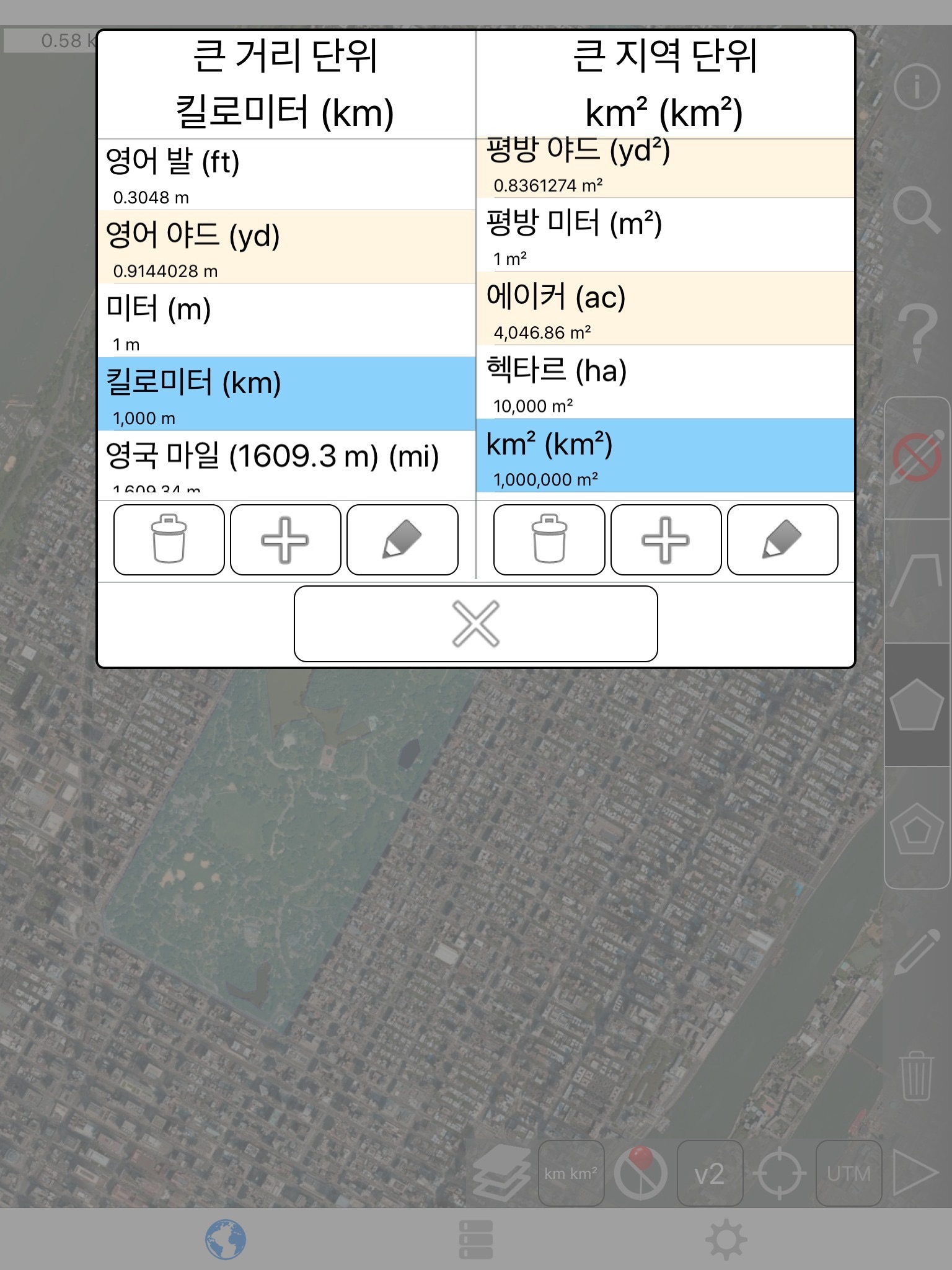
Domyślne jednostki odległości obejmują:
- Miernik
- Stopa
- Stoczni
- Kilometr
- Mile
- Mil
Domyślnymi jednostkami obszaru obejmują:
- Metrowy
- Metrową
- Jard kwadratowy
- Km²
- Square mile
- Square mile morskie
- Akr kwadrat
- Ha kwadrat
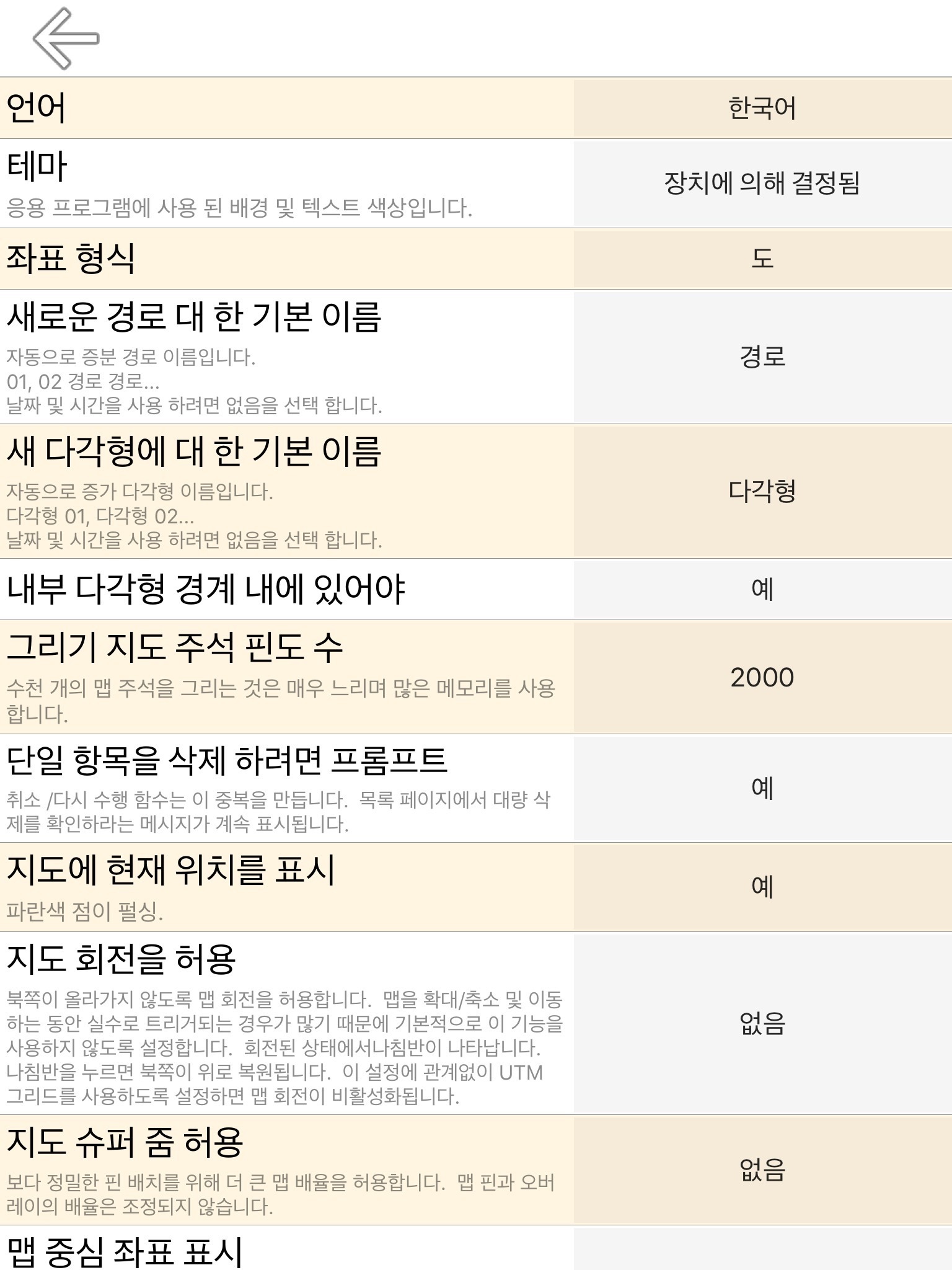
Formatów współrzędnych:
- Stopnie
- Stopnie, minuty
- Stopnie, minuty, sekundy
- UTM/UPS (uniwersalny Transverse Mercator)/(Universal Polar stereograficzny)
- MGRS (wojskowy system referencyjny siatki)
English:
Measure land, roads, parks, countries, lakes, etc from a satellite view. Calculates distances, areas, and perimeters.
Features that this application offers that most competitors do not:
- Add custom distance and area units.
- Draw interior polygons. For example, land area with bodies of water removed.
- Add a point to the middle of a path (Most only allow you to add to the end of the path) Tap to add to the end of a path. Long press to add to the middle of a path.
- Swap two points in a path or polygon.
- Add your current location from GPS receiver.
Features:
- 3 map layer options
- Export and import .kml files via Dropbox, iCloud, email, etc
- Pins are draggable and manually editable
- Name, notes, and color fields for each path and polygon
- Email or text message path and polygon data
- 4 verbosity modes. See only the information that you want to see
- Search by postal code, city, address, etc
- Get addresses near point on map
4 drawing modes:
- Path
- Polygon
- Polygon with hollow spaces inside
- No edit mode (to prevent accidental edits)
Values displayed for paths:
- Total distance
- Incremental distance for each waypoint
Values displayed for polygons:
- Area
- Perimeter
- Distance for each side
Add points to a path or polygon in 1 of 4 ways:
- Tap on the map
- Use current location
- Enter coordinates manually
- Import .kml file
Default distance units include:
- Meter
- Foot
- Yard
- Kilometer
- Mile
- Nautical mile
Default area units include:
- Square meter
- Square foot
- Square yard
- Square kilometer
- Square mile
- Square nautical mile
- Square acre
- Square hectare
Coordinate formats:
- Degrees
- Degrees, minutes
- Degrees, minutes, seconds
- UTM / UPS (Universal Transverse Mercator) / (Universal Polar Stereographic)
- MGRS (Military Grid Reference System)