


Distance and Area Measure
Meet land, wegen, parken, landen, meren, etc vanuit een satellietweergave. Berekent afstanden, gebieden en omtrek.
Functies die deze toepassing biedt dat de meeste concurrenten niet doen:
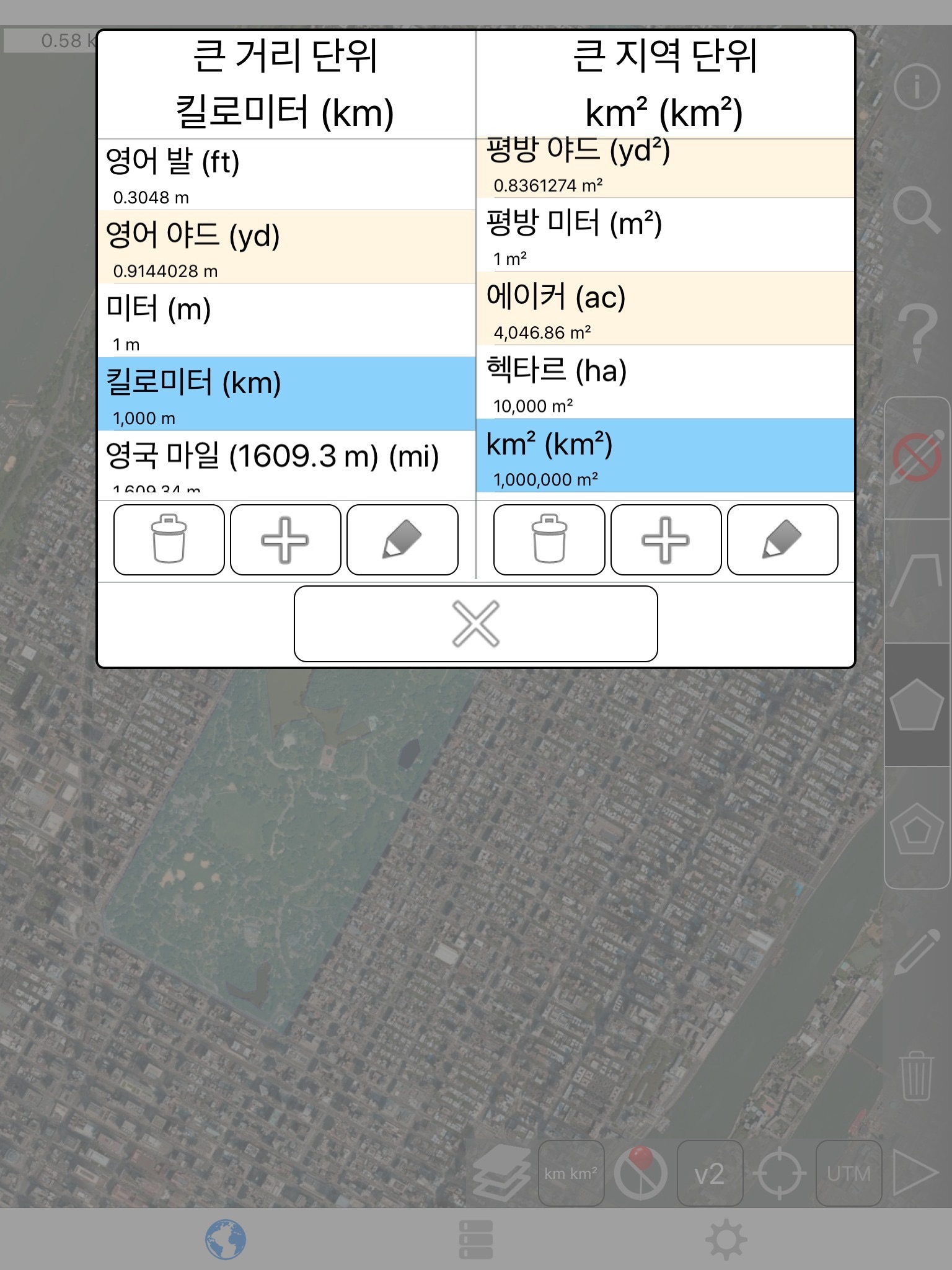
- Voeg aangepaste afstand en oppervlak eenheden.
- Interieur veelhoeken tekenen. Bijvoorbeeld, areaal met waterlichamen verwijderd.
- Een punt toevoegen aan het midden van een pad (meest enige kunt u toevoegen aan het einde van het pad) Tap toe te voegen aan het einde van een pad. Lang indrukken om toe te voegen aan het midden van een pad.
- Ruilen twee punten in een pad of veelhoek.
- Voeg uw huidige locatie van GPS-ontvanger.
Functies:
- 3 kaart Laagopties
- Exporteren en importeren van .kml bestanden via Dropbox, iCloud, e-mail, enz
- Pins zijn te slepen en handmatig te bewerken
- Naam, merkt en kleur velden voor elk pad en veelhoek
- E-mail of tekst berichtgegevens pad en veelhoek
- 4 verbosity modi. Alleen de informatie zien die je wilt zien
- Zoek op postcode, plaats, adres, enz
- Get adressen nabij point op kaart
4 tekening modi:
- Pad
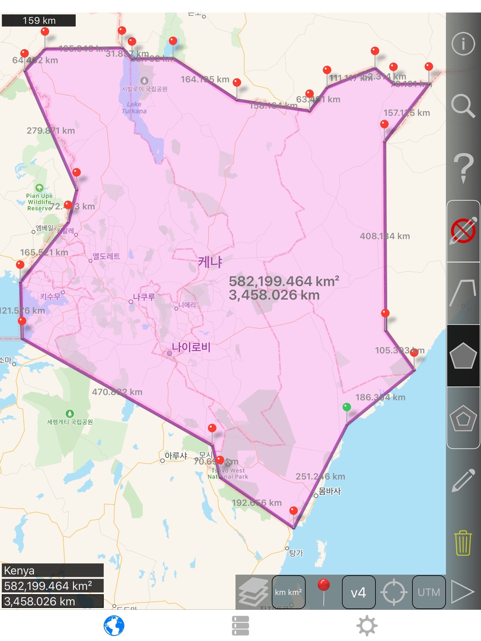
- Veelhoek
- Veelhoek met holle ruimtes binnen
- Geen bewerkingsmodus (om te voorkomen dat per ongeluk bewerkingen)
Waarden die worden weergegeven voor paden:
- De totale afstand
- Incrementele afstand voor elke waypoint
Waarden die worden weergegeven voor veelhoeken:
- Gebied
- Perimeter
- Afstand voor elke zijde
Punten aan een pad of veelhoek in 1 van 4 manieren toevoegen:
- Tik op de kaart
- Gebruik huidige locatie
- Coördinaten handmatig invoeren
- Importbestand .kml
Standaard afstand eenheden omvatten:
- Meter
- Voet
- Yard
- Kilometer
- Mile
- Nautical mile
Standaardeenheden gebied omvatten:
- Vierkante meter
- Vierkante voet
- Vierkante yard
- Vierkante kilometer
- Vierkante mijl
- Vierkante zeemijl
- Vierkante hectare
- Vierkante hectare
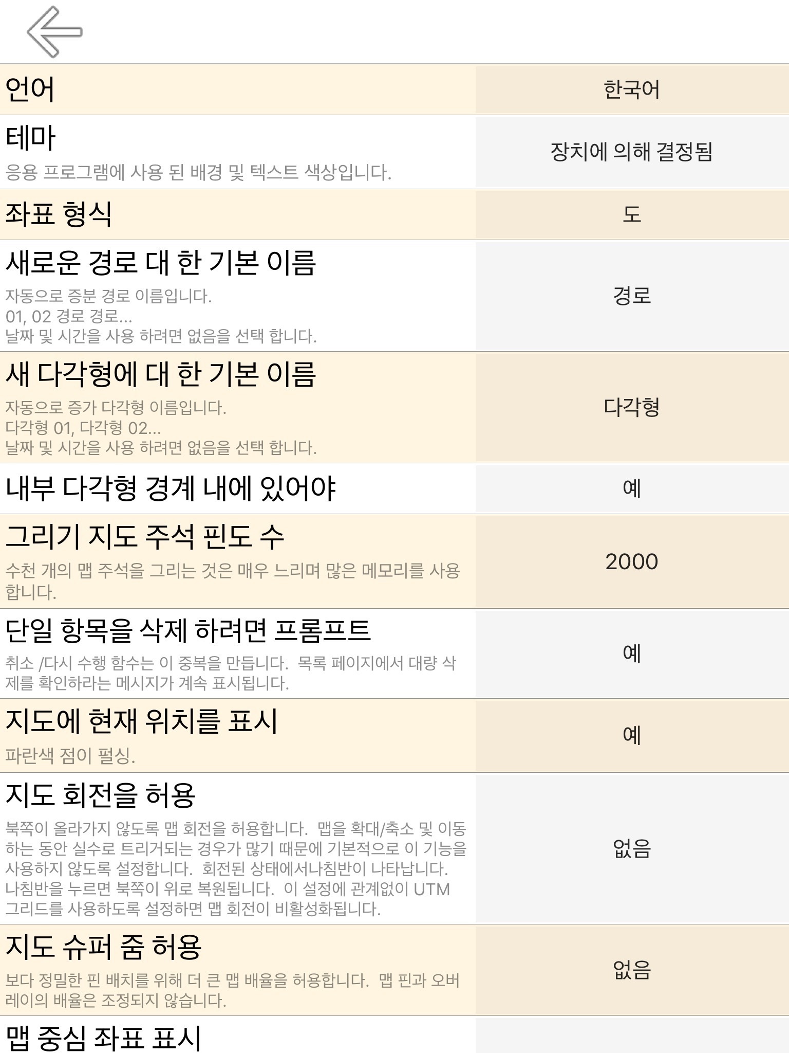
Coördinaat formaten:
- Graden
- Graden, minuten
- Graden, minuten, seconden
- UTM/UPS (universele transversale Mercator)/(universeel polair Stereografisch)
- MGRS (militair grid referentiesysteem)
English:
Measure land, roads, parks, countries, lakes, etc from a satellite view. Calculates distances, areas, and perimeters.
Features that this application offers that most competitors do not:
- Add custom distance and area units.
- Draw interior polygons. For example, land area with bodies of water removed.
- Add a point to the middle of a path (Most only allow you to add to the end of the path) Tap to add to the end of a path. Long press to add to the middle of a path.
- Swap two points in a path or polygon.
- Add your current location from GPS receiver.
Features:
- 3 map layer options
- Export and import .kml files via Dropbox, iCloud, email, etc
- Pins are draggable and manually editable
- Name, notes, and color fields for each path and polygon
- Email or text message path and polygon data
- 4 verbosity modes. See only the information that you want to see
- Search by postal code, city, address, etc
- Get addresses near point on map
4 drawing modes:
- Path
- Polygon
- Polygon with hollow spaces inside
- No edit mode (to prevent accidental edits)
Values displayed for paths:
- Total distance
- Incremental distance for each waypoint
Values displayed for polygons:
- Area
- Perimeter
- Distance for each side
Add points to a path or polygon in 1 of 4 ways:
- Tap on the map
- Use current location
- Enter coordinates manually
- Import .kml file
Default distance units include:
- Meter
- Foot
- Yard
- Kilometer
- Mile
- Nautical mile
Default area units include:
- Square meter
- Square foot
- Square yard
- Square kilometer
- Square mile
- Square nautical mile
- Square acre
- Square hectare
Coordinate formats:
- Degrees
- Degrees, minutes
- Degrees, minutes, seconds
- UTM / UPS (Universal Transverse Mercator) / (Universal Polar Stereographic)
- MGRS (Military Grid Reference System)