


Distance and Area Measure
Messen Sie Land, Straßen, Parks, Länder, Seen usw. von einer Satellitenansicht aus. Berechnet Entfernungen, Flächen und Umfänge.
Funktionen, die diese Anwendung bietet, dass die meisten Konkurrenten nicht tun:
- Fügen Sie benutzerdefinierte Abstand und Fläche Einheiten.
- Innere Polygone zu zeichnen. Z. B. Landfläche mit Gewässer entfernt.
- Fügen Sie einen Punkt in die Mitte eines Pfades (die meisten nur ermöglichen es Ihnen, am Ende des Pfads hinzufügen) tippen, um das Ende eines Pfades hinzufügen. Langes Drücken in die Mitte eines Pfads hinzufügen.
- Tauschen Sie zwei Punkte in einem Pfad oder Polygon.
- Fügen Sie Ihren aktuellen Standort aus GPS-Empfänger.
Merkmale:
- 3-Schicht-Kartenoptionen
- Exportieren und Importieren von KML-Dateien per Dropbox, iCloud, e-Mail, etc.
- Pins sind ziehbar und manuell editierbar
- Name, Notizen und Farbe Felder für jeden Pfad und Polygon
- Per e-Mail oder Nachricht Pfad und Polygon Textdaten
- 4 Ausführlichkeit Modi. Sehen Sie nur die Informationen, die Sie sehen möchten
- Suche nach Postleitzahl, Stadt, Adresse, etc.
- Get Adressen Nahpunkt auf Karte
4 Modi der Zeichnung:
- Pfad
- Polygon
- Polygon mit Hohlräume im Inneren
- Keine Edit-Modus (um versehentliche Änderungen zu vermeiden)
Werte für Pfade angezeigt:
- Gesamtstrecke
- Inkrementelle Abstand für jeden Wegpunkt
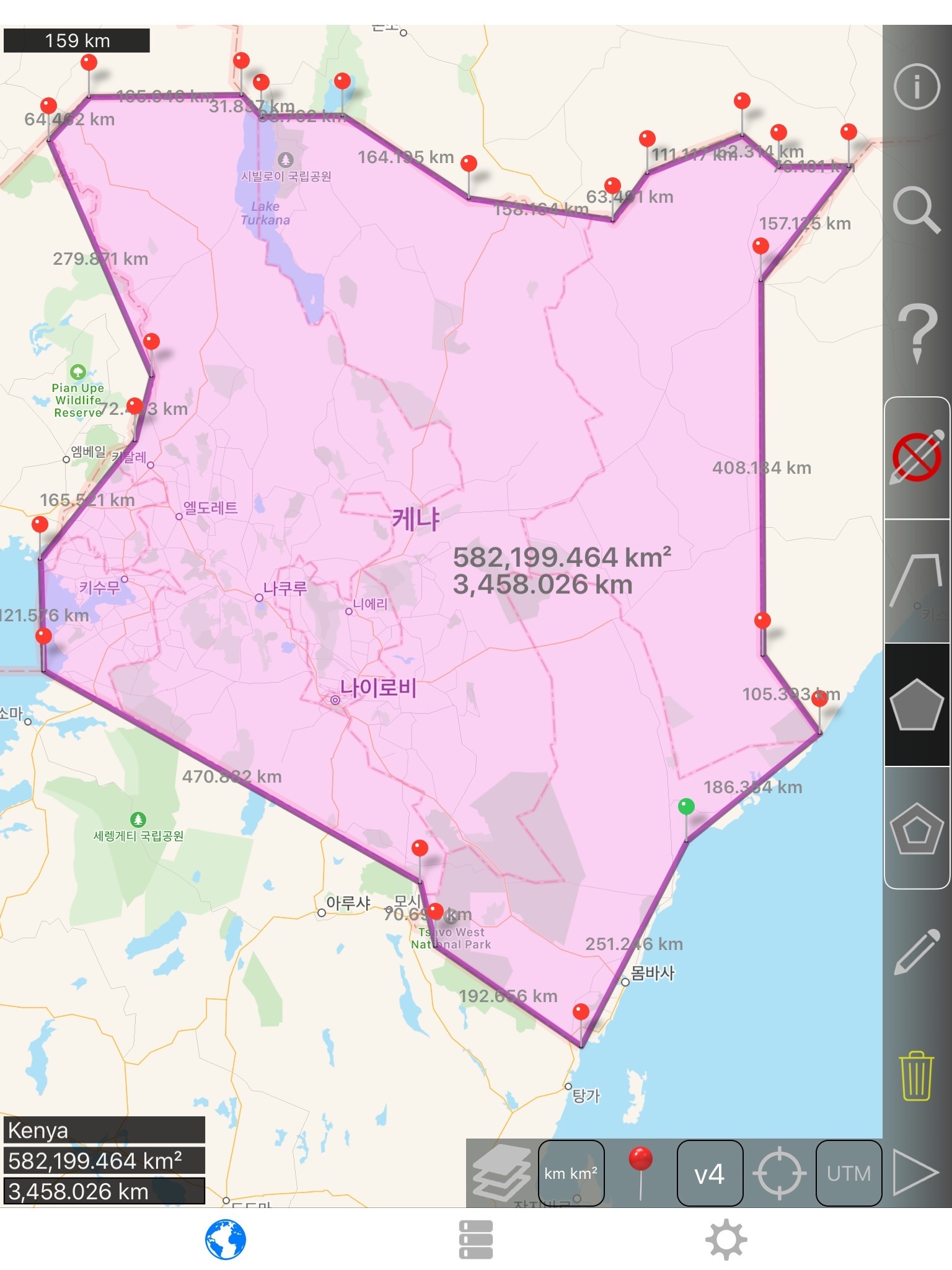
Werte für Polygone angezeigt:
- Bereich
- Perimeter
- Entfernung für jede Seite
Fügen Sie Punkte auf einem Pfad oder Polygon 1 der 4 Möglichkeiten:
- Tippen Sie auf die Karte
- Verwenden Sie aktuelle Position
- Koordinaten manuell eingeben
- KML-Datei import
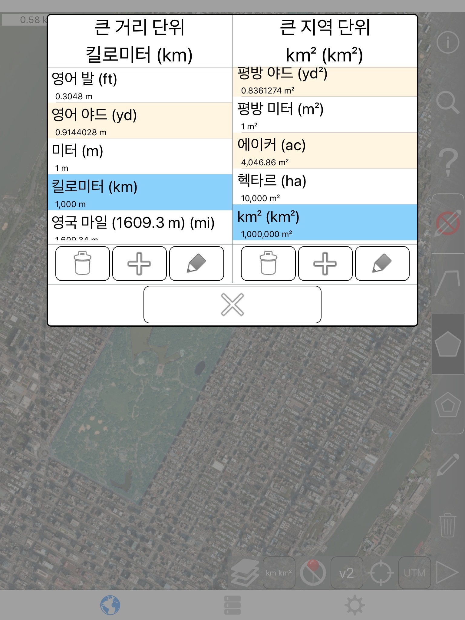
Standard-Distanz-Einheiten sind:
- Meter
- Fuß
- Hof
- Kilometer
- Meile
- Nautische Meile
Standardeinheiten Bereich umfassen:
- Quadratmeter
- Quadratfuß
- Quadratisches yard
- Quadratkilometer
- Quadratische Meile
- Quadratische nautische Meile
- Quadratische acre
- Quadratische Hektar
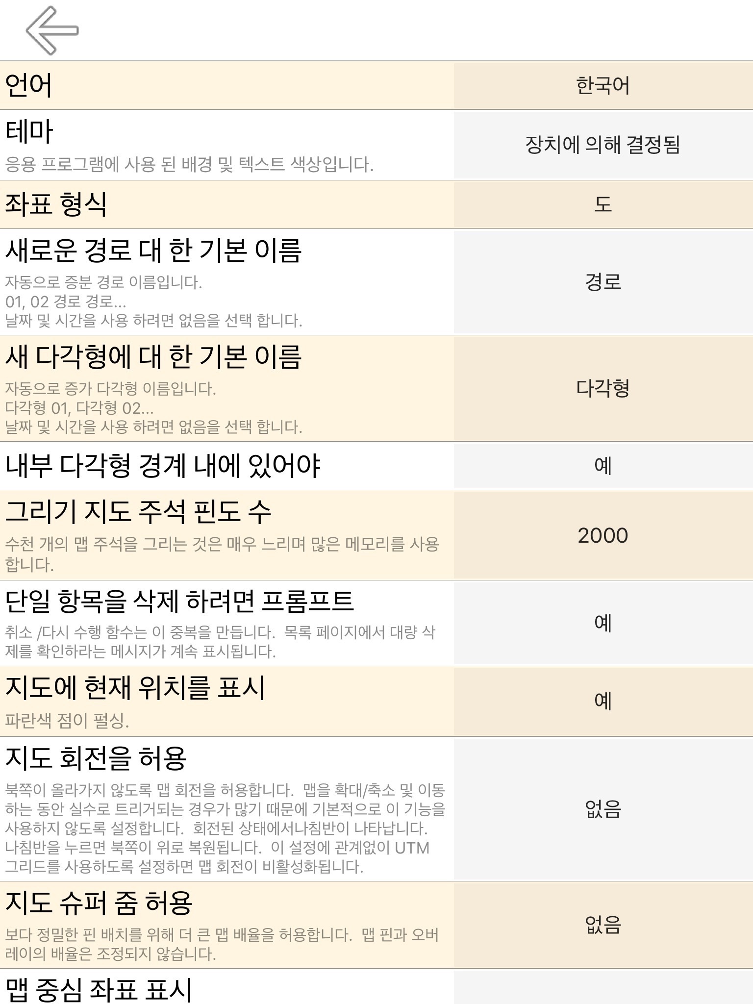
Koordinaten-Formate:
- Grad
- Grad, Minuten
- Grad, Minuten, Sekunden
- UTM / USS (Universal Transverse Mercator) / (Universal Polar Stereographic)
- MGRS (Military Grid Reference System)
English:
Measure land, roads, parks, countries, lakes, etc from a satellite view. Calculates distances, areas, and perimeters.
Features that this application offers that most competitors do not:
- Add custom distance and area units.
- Draw interior polygons. For example, land area with bodies of water removed.
- Add a point to the middle of a path (Most only allow you to add to the end of the path) Tap to add to the end of a path. Long press to add to the middle of a path.
- Swap two points in a path or polygon.
- Add your current location from GPS receiver.
Features:
- 3 map layer options
- Export and import .kml files via Dropbox, iCloud, email, etc
- Pins are draggable and manually editable
- Name, notes, and color fields for each path and polygon
- Email or text message path and polygon data
- 4 verbosity modes. See only the information that you want to see
- Search by postal code, city, address, etc
- Get addresses near point on map
4 drawing modes:
- Path
- Polygon
- Polygon with hollow spaces inside
- No edit mode (to prevent accidental edits)
Values displayed for paths:
- Total distance
- Incremental distance for each waypoint
Values displayed for polygons:
- Area
- Perimeter
- Distance for each side
Add points to a path or polygon in 1 of 4 ways:
- Tap on the map
- Use current location
- Enter coordinates manually
- Import .kml file
Default distance units include:
- Meter
- Foot
- Yard
- Kilometer
- Mile
- Nautical mile
Default area units include:
- Square meter
- Square foot
- Square yard
- Square kilometer
- Square mile
- Square nautical mile
- Square acre
- Square hectare
Coordinate formats:
- Degrees
- Degrees, minutes
- Degrees, minutes, seconds
- UTM / UPS (Universal Transverse Mercator) / (Universal Polar Stereographic)
- MGRS (Military Grid Reference System)